
Travel with Antee: Beyond the Pamirs, Along the Silk Road
Part Three | Kashgar, Tashkurgan, Bachu, Aksu, Kizil, Kuqa and Shaya
Snow-covered mountain passes, twisting roads, ancient paintings, red-rock labyrinths and golden poplar forests: southern Xinjiang is a journey through landscapes that could hardly look more different.
Where: Kashgar Prefecture and Aksu Prefecture, southern Xinjiang
Suggested length: 9–12 days, plus contingency time
Best season: Autumn for poplar forests and comfortable lower-elevation exploration; warmer, stable-weather months for Pamir road travel
The story to follow: A road connecting living cities, high-mountain communities, Buddhist heritage and desert ecology
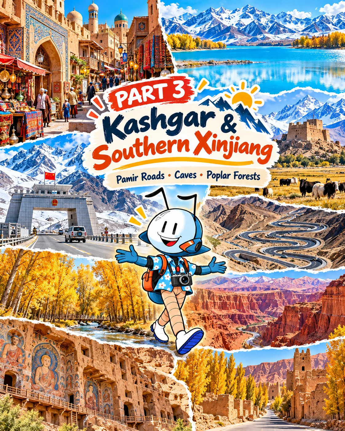
“Are we still in the same region?” Antee wonders. Yesterday there were market stalls and warm bread in Kashgar. Now a vast pale lake lies beneath mountains, and the road seems to climb straight into the sky. Days later, a red-rock landscape will give way to temples carved into cliffs and trees glowing gold beside a desert river.
Southern Xinjiang rewards travelers who resist the temptation to treat it as a collection of quick photo stops. Distances are great; the high country requires caution. But the variety of places, cuisines and histories along the route makes every change in scenery a new chapter.
Kashgar: Begin With People and Place
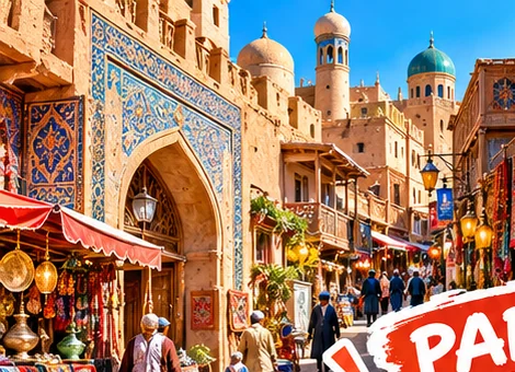
In Kashgar (喀什), start in the old town with a slow walk through lanes, workshops and neighborhood streets. Notice wooden doors, patterned brickwork and courtyards. In markets and restaurants, look for fresh naan, samsa, laghman noodles, kebabs and tea. These are the familiar flavors of a city shaped by trade and a rich Uyghur cultural heritage.
Antee's mission: Draw a doorway pattern and find out whether it is geometric, floral or both.
Photo note: Photograph crafts and streets respectfully. Ask before taking close pictures of people, especially children or those at work.
White Sand Lake: The Color of the Pamirs
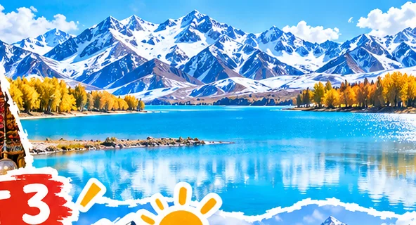
Southwest of Kashgar on the Karakoram Highway, White Sand Lake (白沙湖) near Bulunkou (布伦口) pairs light sand slopes with striking blue water. Its color changes with the sky and wind. The road here reaches significant elevation; pack layers even if Kashgar felt warm.
Photographer's frame: Place the pale sand slopes across the upper half of the image, using the shoreline as a horizontal anchor. Wind can turn the lake from glassy to textured in minutes.
Tashkurgan: A High Plateau With Its Own Character
Tashkurgan (塔什库尔干 / 塔县) is a center of Tajik cultural life in China's Pamir region, surrounded by immense mountains and high grasslands. Give the town and its surrounding landscapes time; this is not simply a place to refuel before a border landmark. Explore designated viewpoints, local food and the remains of Stone City (石头城) where access permits.
Khunjerab Gate (红其拉甫国门)
Further along the Karakoram Highway, the Khunjerab border gate near the China–Pakistan frontier is an extraordinary high-altitude landscape at around 5,100 meters. Tourist access operates under border and visitor controls that can change, and not every traveler or passport holder will be eligible for every route. Arrange access only through official channels and check requirements before starting from Kashgar or Tashkurgan.
Altitude matters: Acclimatize, avoid rushing the ascent, and take headaches, dizziness, breathlessness at rest or unusual fatigue seriously. Families with children should seek medical advice if they have relevant health concerns. Descend and seek urgent help if severe altitude symptoms occur.
Panlong Ancient Road (盘龙古道)
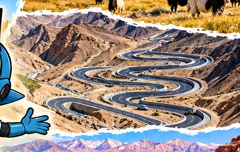
The Panlong Road, also called Wacha Road, loops through steep, dry mountain slopes in astonishing switchbacks. Many tourists come for an overhead view of the road's curves, but it also serves the people living in the highlands. Use marked pullouts, obey traffic restrictions and do not attempt unsafe stops or drone flights.
Antee's mission: Count the hairpin turns you can see in a single photograph. Why would engineers choose a winding road rather than a straight climb?
Bachu: The Forest That Knows the Desert
Returning toward the Tarim Basin, the journey enters a different ecosystem. Around Bachu (巴楚), Euphrates poplars (胡杨) survive in arid landscapes, often associated with seasonal water and desert-edge environments. In autumn, their leaves turn luminous yellow while trunks twist into memorable shapes.
Photo tip: Show one full tree in its environment before moving close to its deeply textured bark. Respect protected areas and stay on marked routes.
Aksu: The Road to Red Rock
Aksu (阿克苏) is an oasis city at the northern edge of the Tarim Basin, famous for its apples and a useful base for exploring the Tianshan foothills. Rather than rushing east to Baicheng, Antee first heads north into Wensu County for a full day among rust-red cliffs. The next day, the journey turns east toward the Buddhist art of the ancient Kucha (Qiuci/龟兹) cultural sphere.
Wensu Grand Canyon (温宿大峡谷) | Tianshan Tomur Grand Canyon (天山托木尔大峡谷)
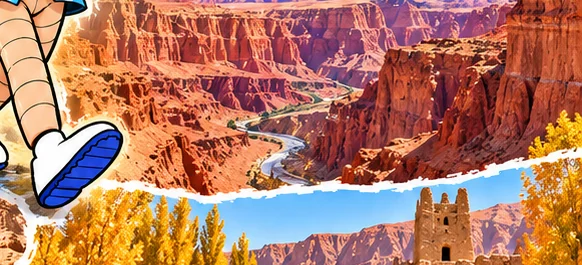
It begins with a ridge the color of burnt orange. Then the road turns and the landscape opens into a maze of towering rock walls, sharply folded layers, dry channels and weather-carved formations. Wensu Grand Canyon, also known as Tianshan Tomur Grand Canyon or Kuduluk Grand Canyon, lies in Wensu County, north of Aksu. Its red-bed landscapes sit alongside remarkable wind-eroded forms, salt-related geology and other landforms that make the area feel like an open-air Earth science museum.
Antee looks up at a cliff where the rock layers curl and buckle like pages of an enormous ancient book. Those bends are clues to a long history of geological forces and erosion. Follow the scenic area's designated routes and look for the differences between jagged ridgelines, smoother slopes and bands of changing color. The canyon is not the same attraction as Kizil Thousand Buddha Caves, which are farther east in Baicheng.
Antee's geology mission: Look for three different rock textures or colors. Can you find a layer that looks tilted or folded? Draw a cross-section of the cliff and label the bands you see.
Photographer's frame: Use a person or a permitted visitor vehicle in the distance to show the cliffs' immense scale. Side lighting reveals the layered texture beautifully, but avoid narrow drainage channels during rain or storm warnings. The sandstone-like tones can shift from amber to copper-red depending on sunlight.
Planning note: Make this a dedicated day trip from Aksu, returning there for the night. Check current park opening, weather and internal transport arrangements. Some routes may require a park shuttle or suitable authorized vehicles; do not assume an ordinary rental car can drive into the canyon.
Kizil Thousand Buddha Caves: The Painted Silk Road
At the Kizil Thousand Buddha Caves (克孜尔千佛洞) in Baicheng, Buddhist paintings and cave architecture tell stories from the ancient Qiuci kingdom and Silk Road cultural exchanges. Patterns, figures and colors here connect art with language, religion and long-distance travel. Centuries of damage and removal have left the surviving paintings especially precious.
An expertly guided visit can bring the art to life. Access to specific caves and photography restrictions vary; do not expect to enter every cave or photograph murals.
Kuqa: An Old Silk Road Cultural Center
Kuqa (库车) has connections to the historic kingdom of Qiuci and offers its own streets, markets and local food. Make time for the atmosphere of an old Silk Road town rather than rushing directly to the next stop. Listen for regional music, admire building details and consider visiting a museum or officially open heritage site to better understand Qiuci art and history.
Shaya: Autumn Gold Among the Poplars
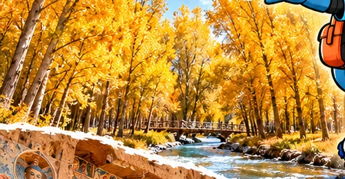
End among the poplar forests near Shaya (沙雅). Along parts of the Tarim River landscape, the trees form a surprising contrast with desert soils and open sky. Gold leaves, pale trunks and twisting branches create fine autumn compositions.
The best colors vary year to year, but late October often offers strong prospects. Never leave established visitor routes to enter protected forest, and check local access conditions.
Antee's nature mission: What helps a tree survive in a place where rainfall is scarce? Look for clues about rivers, groundwater and roots.
A 10-Day Southern Xinjiang Journey
| Day | Suggested route and focus |
|---|---|
| 1 | Kashgar old town, markets and local food |
| 2 | Kashgar to White Sand Lake and Tashkurgan, with slow altitude gain |
| 3 | Tashkurgan and Panlong Road, subject to access and weather |
| 4 | Khunjerab border gate if permitted, then return toward Tashkurgan/Kashgar; allow a full day |
| 5 | Return to Kashgar and travel toward Bachu |
| 6 | Bachu poplar forest and onward toward Aksu |
| 7 | Aksu → Wensu Grand Canyon (Tianshan Tomur Grand Canyon) → overnight in Aksu |
| 8 | Aksu → Kizil Thousand Buddha Caves in Baicheng → Kuqa |
| 9 | Kuqa cultural sights, transfer toward Shaya |
| 10 | Shaya poplar forest and onward departure plans |
Editorial note: This is a long-distance, multi-base road trip, not a 10-day guarantee. Wensu Grand Canyon is grouped with Aksu on Day 7; the Baicheng caves and Kuqa come on Day 8 as the route heads east. A gentler 12-day version offers extra time in Kashgar, Tashkurgan, Aksu and Kuqa and is preferable for many families.
A Taste of the South
Fresh naan, samsa, Uyghur-style laghman, fragrant pilaf and seasonal fruit are part of the journey, with preparations that vary among communities and towns. For a full illustrated food guide, visit Part Four: Flavors of the Silk Road.
Before You Go
- Passports and border permits: Baihaba, Tashkurgan and Khunjerab areas have distinct rules. Eligibility can differ for domestic and foreign travelers; verify current requirements with official authorities and authorized operators.
- High altitude: White Sand Lake and the Pamirs involve rapid elevation gain; never rush a family with symptoms.
- Road and weather: Mountain passes can close after storms, while flash floods can make canyon routes hazardous. At Wensu Grand Canyon, follow the permitted internal-transport and trail arrangements. Road restrictions in Tashkurgan can also prohibit camping, hiking or unauthorized exploration in certain mountain areas.
- Time: Transportation tickets and official schedules use Beijing Time; confirm any informal local timing directly.
- Photo ethics: Respect working communities, sacred sites, wildlife and restricted border installations.
Closing scene: The desert poplars stand still while the afternoon wind moves through their golden leaves. Antee looks at the map, now creased at every fold. A journey that began with mountain roads has become a lesson in how people, water, art and nature connect across one enormous region.
Travel with Antee | Cre8Travel · Xinjiang Series, Part Three